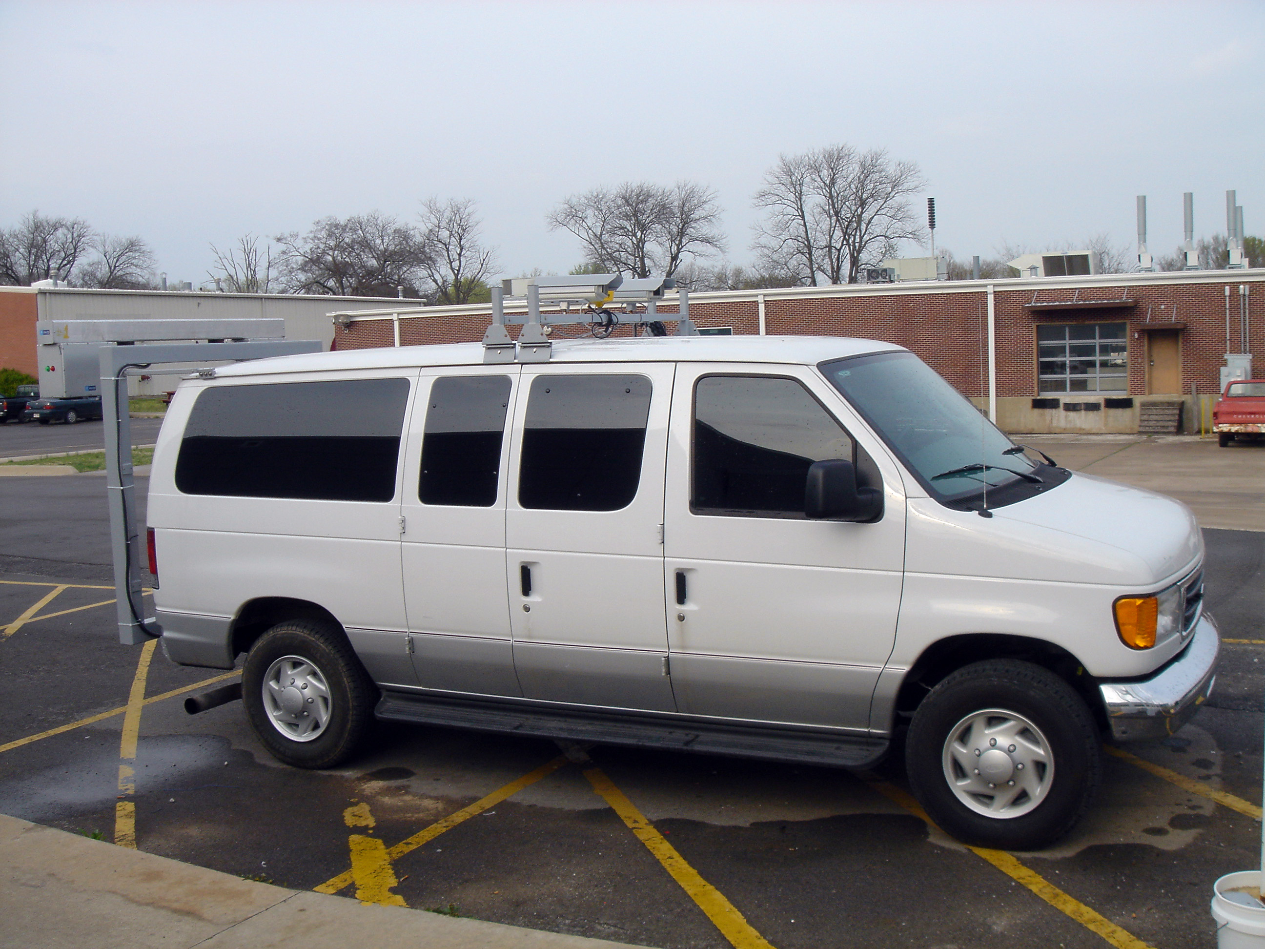
FAYETTEVILLE, Ark. — A University of Arkansas researcher has unveiled the latest generation of the Digital Highway Data Vehicle, the world’s first fully digital highway data system, which records highway surfaces in real time and stores information directly in computers. Used by privates companies and departments of transportation in several states and foreign countries, the system -- a modified Ford van with digital cameras, laser-based illumination technology and a global positioning receiver -- is ready for broad commercial use.
 |
Wang and researchers in his laboratory developed the basic system in the 1990s and introduced the first generation of the vehicle in 2000. That system used conventional lighting to illuminate pavement surfaces recorded by the digital cameras. The current system uses new, laser-based illumination technology, which allows the cameras to produce images with a resolution of 4,096 pixels, roughly equivalent to 1 millimeter, across a 4-meter lane of pavement. The higher resolution allows engineers to view cracks barely visible to the human eye. Wang’s team is the first research and development group to use the laser-illumination technology on any product, he said.
In addition to capturing high-resolution images of pavement, the system can process information in real time. The system’s Automated Distress Analyzer -- software that processes pavement images, produces crack maps and calculates crack geometries and characteristics -- gathers data at a rate of 120 megabytes per second, which means about 120 million pixels are processed every second. The distress analyzer identifies and classifies surface cracks at the same time pavement images are obtained by the digital cameras. All of this is happening while the van is moving at 60 miles per hour. The software also can be operated in a lab environment where the distress analyzer is used in post-processing mode.
By identifying cracks classified as longitudinal, transverse, block or alligator -- rippled cracks that look and feel like the back of an alligator -- the fully automated system saves time and resources. Highways must be examined regularly for signs of wear, a process that begins from the moment they are built. Most state highway departments try to examine every mile of highway each year to determine conditions and maintenance needs. Conventional methods have included manual surveys by human observation or use of specially equipped vehicles to drive over every mile of highway and videotape the road surface.
“There are many problems with manual surveys,” Wang said. “They are time-consuming and thus expensive, hazardous for employees and subjective, which means they have a wide range of errors. Basically, the data are not repeatable or consistent, which doesn’t help highway departments that are trying to identify problem areas and develop maintenance priorities.”
Contacts
Kelvin Wang, professor
of civil engineering
(479) 575- 8425,
kcw@uark.edu
Matt McGowan, science and research communications
officer
(479) 575-4246, dmcgowa@uark.edu