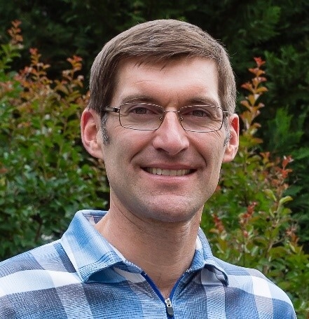
Henry "Hank" Theiss, a research associate professor in the Center for Advanced Spatial Technologies and the Department of Geosciences, has been awarded the 2021 Fairchild Award by ASPRS, the Imaging and Geospatial Information Society.
According to the society, "the Photogrammetric Fairchild Award is designed to stimulate the development of the art of photogrammetry in the United States."
"The Fairchild Award is the highest merit-based award bestowed by the Society," said Charles Toth, professor of civil, environmental and geodetic engineering at The Ohio State University and former president of ASPRS.
Geomatics is the discipline concerned with the collection, distribution, storage, analysis, and processing of geospatially referenced data. The field encompasses surveying, photogrammetry, geodesy, global navigation satellite systems, lidar, and radar imaging among others.
While many of the sub-fields of geomatics have been studied and used for decades, the demand for spatial information to inform autonomous vehicles, create and manage resilient urban and natural environments, sustain agriculture, manage complex distribution systems, and provide interactive and accurate maps to the public has elevated the field and created innovations in the science and technology of managing and analyzing geospatial data.
Theiss has more than 23 years of experience supporting geomatics research projects, primarily devising innovative photogrammetric solutions, for a variety of Department of Defense and intelligence community contractors, especially the National Geospatial-Intelligence Agency. He graduated from Purdue University in 2000; his dissertation topic was "Photogrammetric Triangulation and Dynamic Modeling of Airborne Video Imagery."
After his graduation he spent a year as an assistant visiting professor at Purdue, teaching graduate-level courses and continuing his research. In 2001 he became chief scientist in photogrammetry at Centauri LLC of Arlington Virginia. During his time there he led a team of scientists to perform research and analyses in photogrammetry, error propagation, EO/IR/SAR/LIDAR sensor modeling from airborne and spaceborne platforms, image formation, close range applications, registration, and tool validation.
His work significantly advanced the concept of generic sensor modeling of optical line scanners and frame sequences. He developed a new bistatic SAR sensor model with a simulated data testbed and performed associated geopositioning analysis. He supported the Community Sensor Model Working Group, which fosters collaboration among government, industry and academia to facilitate standardization, interoperability and advancement of geopositioning capabilities associated with remote sensing systems.
In 2020 Theiss joined the Center for Advanced Spatial Technologies at the University of Arkansas as a research associate professor, where he continues to make significant contributions to the field of photogrammetry.
Theiss has numerous publications to his credit, including a section in the Manual of Photogrammetry, Sixth Edition on the Community Sensor Model Concept, and many important papers in Photogrammetric Engineering and Remote Sensing, ISPRS International Archives of the Photogrammetry, Remote Sensing, and Spatial Information Sciences, and SPIE conferences.
"Hank is among the most respected photogrammetrists in the world and we are fortunate to be working with him," said Jackson Cothren, director of CAST. "In his short time here, he has already made significant contributions to CAST and the University of Arkansas."
Toth also said that, "with the addition of Dr. Theiss, CAST will be extremely powerful in the field of geomatics; among the very best in the United Sates."
Another colleague, Ayman Habib, professor of civil engineering at Purdue University, said, "This is a well-deserved recognition of Dr. Theiss' exceptional contribution to the field of Geomatics, in general, and photogrammetry in particular, especially in the development of the Community Sensor Models for LiDAR and Electro-Optical remote sensing systems."
Devin White, an R&D manager for autonomous sensing and perception at Sandia National Laboratory who has worked with Theiss for many years, said, "Hank has the unique ability to quickly grasp and solve extraordinarily complex photogrammetric problems associated with high consequence sensing systems, then turn around and share his innovations with other professionals in ways that advance the entire discipline. The impact of his contributions, in both academic and practical contexts, cannot be overstated."
Founded in 1934, the American Society for Photogrammetry and Remote Sensing is a scientific association serving thousands of professional members around the world. Its mission is to advance knowledge and improve understanding of mapping sciences to promote the responsible applications of photogrammetry, remote sensing, geographic information systems and supporting technologies.
The Center for Advanced Spatial Technologies, or CAST, is a multidisciplinary center for spatial research and technology housed within the Fulbright College of Arts and Sciences at the University of Arkansas. CAST focuses on fundamental and applied research in geographic information science and Ggeomatics. The center and its 30 faculty, staff and students receive competitive funding from a variety of federal, state and other entities.
Topics
Contacts
Hank Theiss, research associate professor
Center for Advanced Spatial Technologies
479-575-6159, theiss@uark.edu
