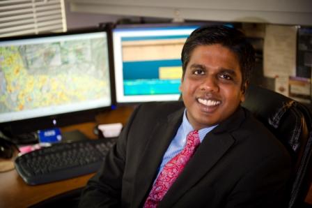
The Graduate Civil Engineering Seminar Series will bring Thomas Oommen of Michigan Technological University to the University of Arkansas campus Monday, April 17, for a special lecture on Integrated Remote Sensing Techniques for Geohazard Characterization and Geotechnical Asset Management.
The lecture will take place in the John A. White Jr. Engineering Hall (ENGR) Room 304 from 11:50 a.m. to 12:40 p.m. Light refreshments will be provided.
Abstract: Since the collapse of Mount St. Helens, Washington, in May of 1980, the structural failure of volcanoes has been widely recognized as a pervasive and potentially devastating phenomenon. Considering the logistical challenges of monitoring deformation at an active volcano, remote sensing techniques are particularly advantageous. This is true of Pacaya Volcano in Guatemala, a dominantly basaltic complex that has been continually active since the 1960s. Concerns over the stability of the edifice were investigated using a remote sensing technique known as Interferometric Synthetic Aperture Radar (InSAR) surrounding the 2010 eruption. Interferograms produced using ALOS PALSAR and UAVSAR data reveal that the southwest flank slid 3 meters during this eruptive phase, resulting in the largest measured slope instability witnessed in a single event at a volcano that did not result in a catastrophic landslide.
Another challenging application where remote sensing could provide a viable solution is monitoring the condition of geotechnical assets (e.g. retaining walls, cut slopes, and embankments) along transportation corridors. Current management practices restore the assets after failure, rather than identifying and remediating hazardous conditions before they fail. Displacement and velocity computed using InSAR and photogrammetry for geotechnical assets indicate that the current condition and historic trends can be quantified using remote sensing.
Bio: Oommen's research focuses on developing improved susceptibility characterization and documentation of geo-hazards (e.g. earthquakes, landslides) and spatial modeling of georesources (e.g. mineral deposits) over a range of spatial scales and data types. He has adopted an inter-disciplinary research approach from two main areas, specifically aerial/satellite based remote sensing for obtaining data and artificial intelligence/machine learning based methods for data processing and modeling. Oommen earned his doctoral degree in Geotechnical Engineering from Tufts University. He holds an M.S. degree in Systems Engineering from the University of Alaska Fairbanks and a B.E. degree in Civil Engineering from Bangalore University.
More info about Oommen's research at Michigan Technological University can be found at www.geo.mtu.edu/~toommen.
Topics
Contacts
Sean Salazar,
Civil Engineering
484-821-7918,
