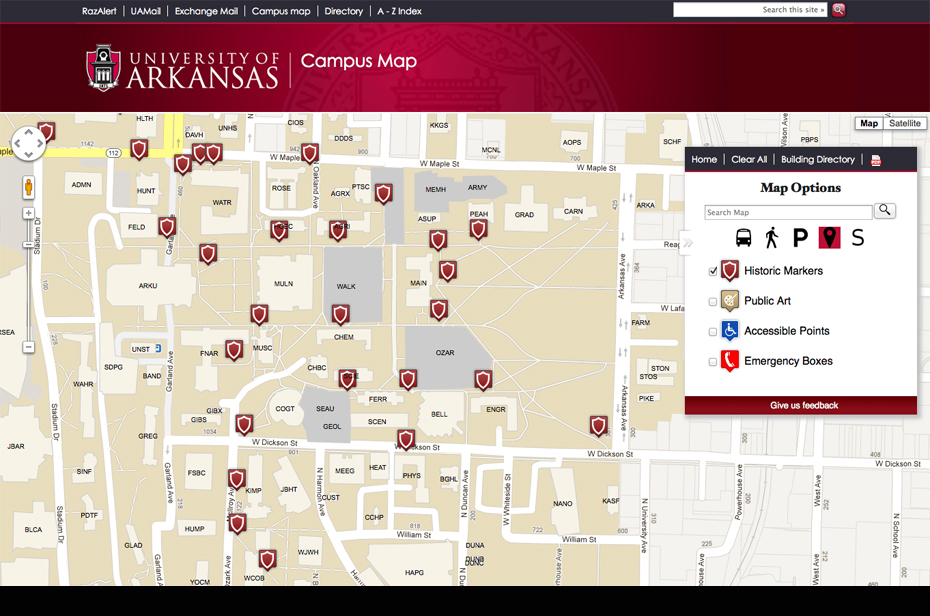
FAYETTEVILLE, Ark. – It’s never been easier to find campus landmarks and get directions at the University of Arkansas thanks to a new digital version of the campus map that is intuitive and easy to use. The new application, campusmaps.uark.edu, is integrated with Google Maps, the industry-leading mapping interface.
"The number of students and visitors who access information through their mobile devices continues to increase, so the new map will be much more convenient and useful for them," said Chris Nixon, director of digital design and development in the office of university relations. "We tried to make everything on campus searchable and shareable so finding buildings or specific locations will be as easy as possible."
For example, a user’s cell phone can find the location of the user on the mobile version of the map through GPS technology.
Other features include:
- Pop up windows that provide information about each building on the map, including the address, and which allow that information to be emailed or shared on Facebook, Twitter or Google Plus.
- A waypoint system that identifies the best walking route between two locations on campus.
- Bus routes and parking lots listed by color.
- Lists of bicycle racks, motorcycle/scooter parking, public art, historical markers, handicap accessible points, emergency phone boxes, dining locations and computer labs.
- An intuitive search for buildings and other points of interest that auto-suggests possible locations.
- A comprehensive listing of buildings along with their four-character campus codes.
"While the new map is a vast improvement over the previous static version, it’s only the beginning of what we can do,” said Nixon. “This is really just the foundation on which we plan to build additional features that will make navigating the campus even easier in the future.”
Other planned features include real-time tracking on the map of buses, allowing patrons to know when the next bus will arrive at a particular stop; handicap accessible routes from parking to buildings; a Senior Walk lookup; the ability to place a map on any website; and the ability to show routes for the university’s yearly move-in project.
The new campus map replaces a static site that was implemented in 2006.
Digital design and development, a department of the office of university relations responsible for the creation and maintenance of all university technology-based communications, partnered with the Center for Advanced Spatial Technologies, the department of facilities management, the office of educational access and the department of transit and parking to complete the campus map project.
Topics
Contacts
Chris Nixon, director of digital design and development
University Relations
479-575-5629, cnixon@uark.edu
Steve Voorhies, manager of media relations
University Relations
479-575-3583,
voorhies@uark.edu